
How to Map the World's Ports by Country and Harbor Size
On this page
Problem statement
Mapping ports by country looks like a group-by on the World Port Index's Country Code column, and the column is not a code: it holds 195 country and territory names, a third of which match no standard map's names, from "Burma" to "Caribbean Netherlands". Ports also sit on the coast, so a point-in-polygon join to generalised country outlines misses many. This page counts ports by country, shows which names fail to match, joins by nearest country instead, and compares the share of large ports between countries and continents.
Quick answer
Count ports by the country column, all ports and medium or large only:
world = gpd.read_file("data/ne_110m_admin_0_countries.zip")[["ADMIN", "CONTINENT", "geometry"]]
c = ports["Country Code"].value_counts()
print(c.head(10).to_string())
big = ports[ports["Harbor Size"].isin(["Large", "Medium"])]["Country Code"].value_counts()
print(big.head(6).to_dict())
Country Code
United States 666
Canada 285
United Kingdom 186
Japan 163
Norway 141
Indonesia 123
Italy 123
Sweden 92
Philippines 71
Denmark 69
{'United States': 59, 'Japan': 37, 'United Kingdom': 31, 'Italy': 22, 'Canada': 19, 'France': 18}
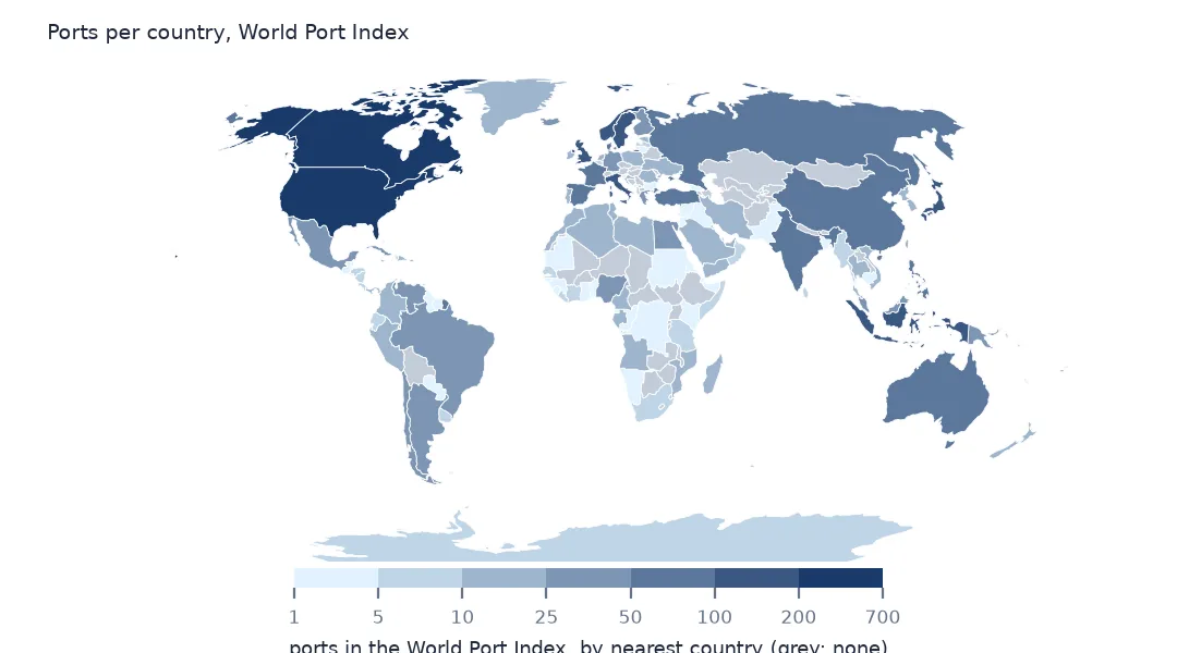
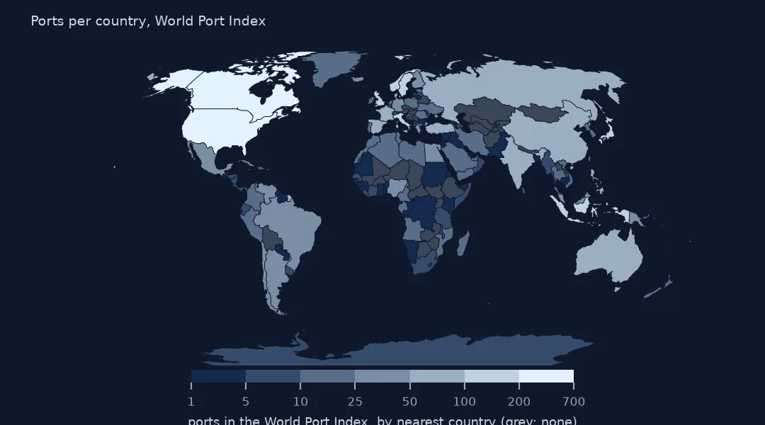
The United States has 666 ports in the index, Canada 285, the United Kingdom 186, Japan 163 and Norway 141, then Indonesia, Italy, Sweden, the Philippines and Denmark. Counting only medium and large ports, the United States still leads with 59, then Japan with 37 and the United Kingdom with 31: the long counts for Canada and Norway are mostly small harbours on long, indented coasts.
Names, nearest countries and large ports
1. Country names that do not match a map
unmatched = sorted(set(c.index) - set(world.ADMIN))
print(f"country values: {len(c)}; not a Natural Earth country name: {len(unmatched)}")
print(unmatched[:12])
country values: 195; not a Natural Earth country name: 71
['American Samoa', 'Antigua and Barbuda', 'Aruba', 'Bahrain', 'Barbados', 'Bermuda', 'British Indian Ocean Territory', 'British Virgin Islands', 'Burma', 'Cabo Verde', 'Caribbean Netherlands', 'Cayman Islands']
71 of the 195 country values are not a Natural Earth country name: territories such as American Samoa, Aruba and Bermuda, which the 1:110m countries do not separate, small states missing at that scale, and different spellings such as Burma for Myanmar and Cabo Verde. A join on names drops all their ports, and a lookup table is the fix if you need the index's own country.
2. Join by location instead
j = gpd.sjoin_nearest(ports.to_crs(3857), world.to_crs(3857), how="left", distance_col="m")
j = j[~j.index.duplicated()]
print(f"ports on land in a country: {(j.m == 0).sum():,}; within 10 km of one: {(j.m.between(1, 10_000)).sum():,}; median offshore distance: {j.loc[j.m > 0, 'm'].median() / 1000:.1f} km")
print((j["Country Code"] == j.ADMIN).mean().round(3))
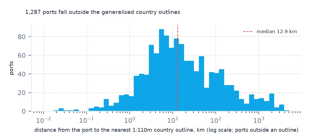
ports on land in a country: 2,520; within 10 km of one: 575; median offshore distance: 12.9 km
0.753
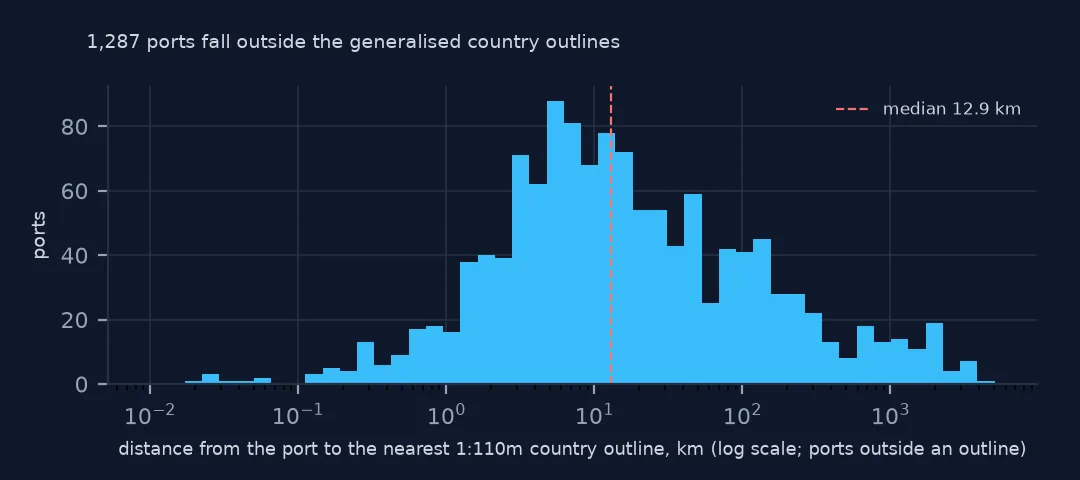
Joining each port to its nearest country by distance avoids the names. 2,520 ports fall on land in a country outline and 575 within 10 km; the median offshore port is 12.9 km out, because the generalised outlines cut off headlands and islands. The nearest country agrees with the index's own country for 75.3% of ports; the rest are mostly the territories and islands that the coarse map merges or misses.
3. The share of large ports
share = j.groupby("ADMIN").agg(ports=("Main Port Name", "size"), large=("Harbor Size", lambda s: s.isin(["Large", "Medium"]).mean()))
print(share[share.ports >= 50].sort_values("large", ascending=False).round(3).to_string())
ports large
ADMIN
Spain 50 0.340
France 71 0.254
China 68 0.235
Japan 160 0.231
Australia 66 0.212
Italy 123 0.195
India 55 0.164
United Kingdom 199 0.156
Russia 81 0.136
Sweden 101 0.129
Indonesia 114 0.096
Turkey 65 0.092
United States of America 662 0.092
Philippines 72 0.083
Norway 143 0.077
Canada 295 0.061
Denmark 58 0.052
Among countries with 50 or more ports, Spain has the highest share of medium and large ports, 34.0%, then France at 25.4%, China, Japan and Australia above 20%. The United States has 9.2% and Canada 6.1%, Norway 7.7% and Denmark 5.2%: the index lists many small harbours there and few elsewhere.
Ports by continent and size
The data used on this page
The US National Geospatial-Intelligence Agency's World Port Index (Pub. 150), the CSV served by its Maritime Safety Information site, downloaded on 28 October 2026 and saved on this site, because NGA revises the index as port information changes. A US government publication, free to use. Depths and lengths are in metres. Countries, land and populated places are Natural Earth's, public domain.
from pathlib import Path
import zipfile

import geopandas as gpd
import numpy as np
import pandas as pd
import requests

Path("data").mkdir(exist_ok=True)
# NGA's World Port Index (Pub. 150) as CSV, with Natural Earth's populated places, countries and land. Saved
# 28 October 2026: NGA revises the index as port information changes.
# Live: https://msi.nga.mil/api/publications/download?type=view&key=16920959/SFH00000/UpdatedPub150.csv
ARCHIVE = "nga-world-port-index-2026-10-28.zip"
if not Path(f"data/{ARCHIVE}").exists():
    Path(f"data/{ARCHIVE}").write_bytes(requests.get(f"https://data.spatialworkflow.io/{ARCHIVE}", timeout=600).content)
Z = zipfile.ZipFile(f"data/{ARCHIVE}")
for f in ["ne_10m_populated_places_simple.zip", "ne_110m_admin_0_countries.zip", "ne_50m_land.zip"]:
    Path(f"data/{f}").write_bytes(Z.read(f))
wpi = pd.read_csv(Z.open("UpdatedPub150.csv"), encoding="utf-8-sig")
wpi = wpi.replace(r"^\s*$", np.nan, regex=True)                                  # blank cells are a single space
DEPTHS = [c for c in wpi.columns if c.endswith("(m)")]
wpi[DEPTHS] = wpi[DEPTHS].where(wpi[DEPTHS] > 0)                                    # 0 means not recorded
ports = gpd.GeoDataFrame(wpi, geometry=gpd.points_from_xy(wpi.Longitude, wpi.Latitude), crs=4326)
print(f"World Port Index: {len(ports):,} ports in {ports['Country Code'].nunique()} countries and territories")
World Port Index: 3,807 ports in 195 countries and territories
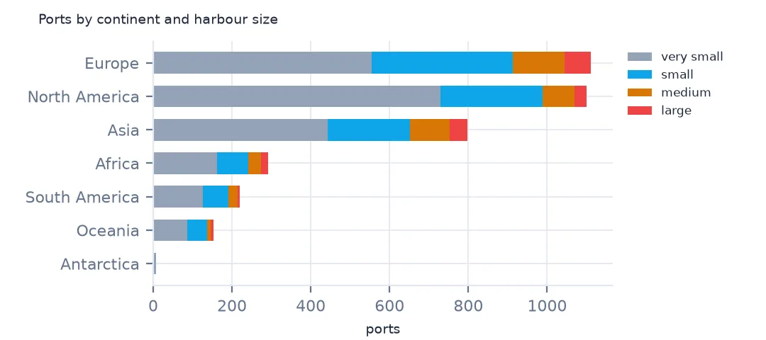
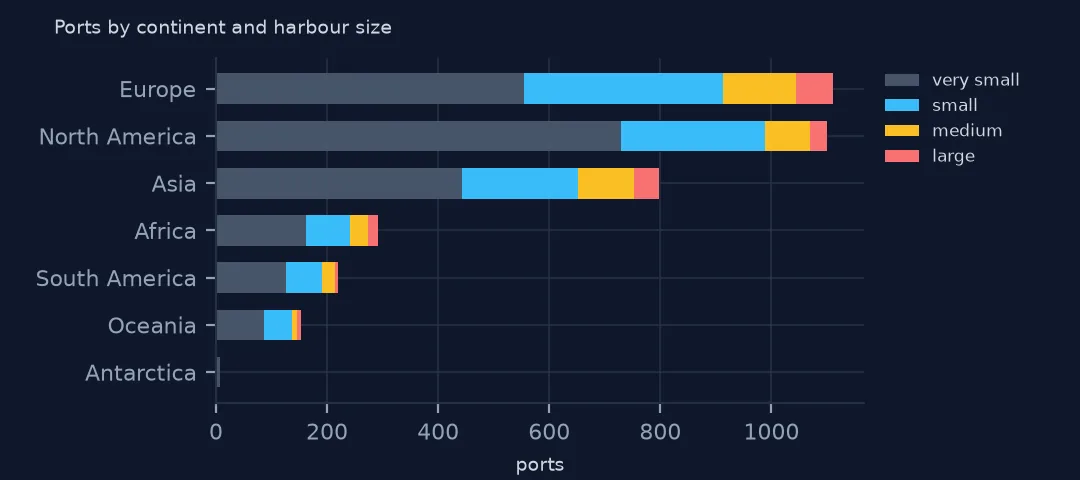
Example 1: ports by continent and size
print(pd.crosstab(j.CONTINENT, j["Harbor Size"])[["Very Small", "Small", "Medium", "Large"]].to_string())Harbor Size Very Small Small Medium Large
CONTINENT
Africa 162 80 31 18
Antarctica 7 1 0 0
Asia 443 208 101 45
Europe 555 358 131 67
North America 729 260 80 31
Oceania 87 49 10 7
South America 126 65 23 6
By continent, Europe has the most small, medium and large ports, North America the most very small ones, 729, and Asia the second most large ones, 45. Africa and South America have few ports of any size for their coastlines, which says as much about how thoroughly each coast is described as about how many ports it has.
Internal links
- Reading the index — the columns
- Ports by sea — the water body column instead of the country
- Nearest port to a place — distances from cities
- Country from coordinates — the location join in general