
How to Count the World's Ports by Ocean and Sea
On this page
Problem statement
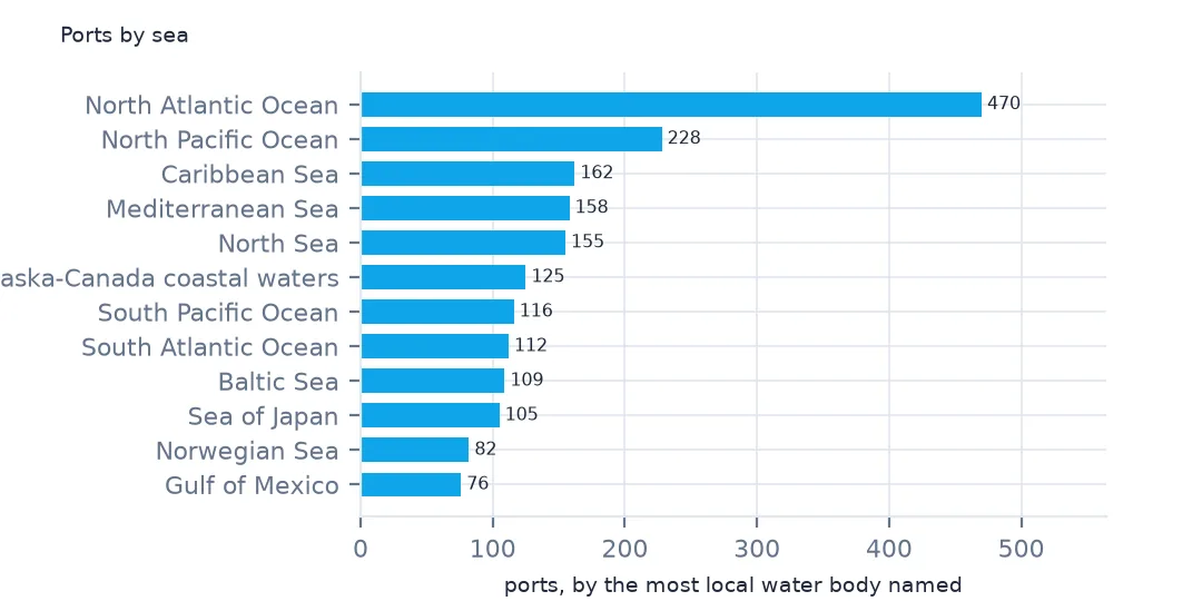
Which oceans and seas have the most ports? The World Port Index's World Water Body column names the water each port lies on, as a chain from the most local water to the ocean: "Gulf of Finland; Baltic Sea; North Atlantic Ocean". Grouping on the whole string splits the same ocean into dozens of groups, and grouping on the first item mixes gulfs with oceans. This page counts ports by the most local water body and by the ocean at the end of the chain, finds where the large ports are, and checks the IHO sea area column that should do the same job.
Quick answer
Take the first water body in each chain and count the ports:
wb = ports["World Water Body"].str.split(";").str[0].str.strip()
print(wb.value_counts().head(10).to_string())
print(f"water bodies: {wb.nunique()}; ports listing more than one: {ports['World Water Body'].str.contains(';', na=False).sum()}")
World Water Body
North Atlantic Ocean 470
North Pacific Ocean 228
Caribbean Sea 162
Mediterranean Sea 158
North Sea 155
Alaska-Canada coastal waters 125
South Pacific Ocean 116
South Atlantic Ocean 112
Baltic Sea 109
Sea of Japan 105
water bodies: 136; ports listing more than one: 2808
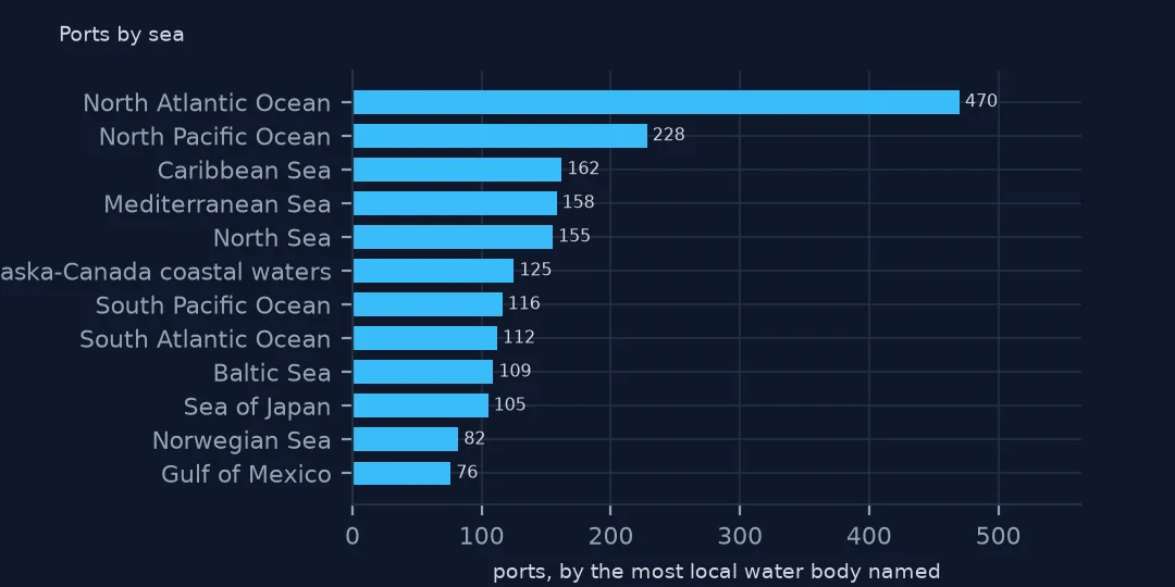
By the first water body, the North Atlantic has the most ports, 470, then the North Pacific with 228, the Caribbean 162, the Mediterranean 158, the North Sea 155 and the Alaska-Canada coastal waters 125. There are 136 different water bodies, and 2,808 ports list more than one: the column is a hierarchy, not a single value.
Oceans, large ports and IHO areas
1. Oceans from seas
chain = ports["World Water Body"].str.split(";").apply(lambda l: [x.strip() for x in l] if isinstance(l, list) else [])
ports["ocean"] = chain.str[-1]                                    # the list runs from the most local water to the ocean
print(chain.str.len().value_counts().sort_index().to_dict())
print(ports.ocean.value_counts().head(8).to_string())
{1: 999, 2: 2319, 3: 489}
ocean
North Atlantic Ocean 1939
North Pacific Ocean 833
Indian Ocean 338
South Pacific Ocean 264
Great Lakes 232
South Atlantic Ocean 144
Arctic Ocean 57
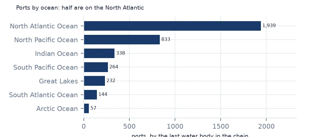
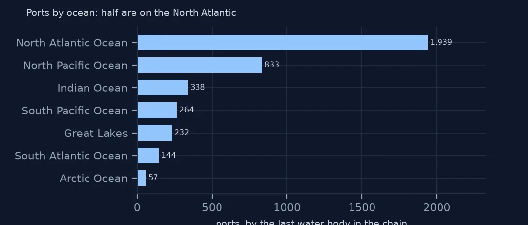
999 ports list one water body, 2,319 two and 489 three. The last item is the ocean, or the Great Lakes for ports on them. By it, the North Atlantic has 1,939 ports, half the index, the North Pacific 833, the Indian Ocean 338, the South Pacific 264, the Great Lakes 232, the South Atlantic 144 and the Arctic 57. The Atlantic's share comes from Europe's and North America's many small harbours.
2. Large ports by water body
lg = ports[ports["Harbor Size"].isin(["Large", "Medium"])]
print(wb[lg.index].value_counts().head(8).to_string())
World Water Body
North Atlantic Ocean 59
North Sea 35
Mediterranean Sea 32
North Pacific Ocean 25
Caribbean Sea 25
Sea of Japan 23
Baltic Sea 19
South Atlantic Ocean 16
Medium and large ports are on the same waters as the others, but in a different order: the North Atlantic coast itself has 59, the North Sea 35, the Mediterranean 32, then the North Pacific and the Caribbean with 25 each and the Sea of Japan with 23.
3. The IHO sea areas
print(f"IHO S-130 sea area given: {ports['IHO S-130 Sea Area'].notna().sum():,} of {len(ports):,}")
print(ports["IHO S-130 Sea Area"].value_counts().head(6).to_dict())
IHO S-130 sea area given: 0 of 3,807
{}
The IHO S-130 Sea Area column, meant to give each port's sea under the International Hydrographic Organization's standard list, is empty for all 3,807 ports. The water body chain is the only sea information in the file.
Large ports' share by sea
The data used on this page
The US National Geospatial-Intelligence Agency's World Port Index (Pub. 150), the CSV served by its Maritime Safety Information site, downloaded on 28 October 2026 and saved on this site, because NGA revises the index as port information changes. A US government publication, free to use. Depths and lengths are in metres.
from pathlib import Path
import zipfile

import geopandas as gpd
import numpy as np
import pandas as pd
import requests

Path("data").mkdir(exist_ok=True)
# NGA's World Port Index (Pub. 150) as CSV, with Natural Earth's populated places, countries and land. Saved
# 28 October 2026: NGA revises the index as port information changes.
# Live: https://msi.nga.mil/api/publications/download?type=view&key=16920959/SFH00000/UpdatedPub150.csv
ARCHIVE = "nga-world-port-index-2026-10-28.zip"
if not Path(f"data/{ARCHIVE}").exists():
    Path(f"data/{ARCHIVE}").write_bytes(requests.get(f"https://data.spatialworkflow.io/{ARCHIVE}", timeout=600).content)
Z = zipfile.ZipFile(f"data/{ARCHIVE}")
for f in ["ne_10m_populated_places_simple.zip", "ne_110m_admin_0_countries.zip", "ne_50m_land.zip"]:
    Path(f"data/{f}").write_bytes(Z.read(f))
wpi = pd.read_csv(Z.open("UpdatedPub150.csv"), encoding="utf-8-sig")
wpi = wpi.replace(r"^\s*$", np.nan, regex=True)                                  # blank cells are a single space
DEPTHS = [c for c in wpi.columns if c.endswith("(m)")]
wpi[DEPTHS] = wpi[DEPTHS].where(wpi[DEPTHS] > 0)                                    # 0 means not recorded
ports = gpd.GeoDataFrame(wpi, geometry=gpd.points_from_xy(wpi.Longitude, wpi.Latitude), crs=4326)
print(f"World Port Index: {len(ports):,} ports in {ports['Country Code'].nunique()} countries and territories")
World Port Index: 3,807 ports in 195 countries and territories
Example 1: ports per sea against the sea's coastline
r = ports.groupby(wb).agg(ports=("Main Port Name", "size"), large=("Harbor Size", lambda s: s.isin(["Large", "Medium"]).mean()))
print(r[r.ports >= 50].sort_values("large", ascending=False).round(3).head(8).to_string())
ports large
World Water Body
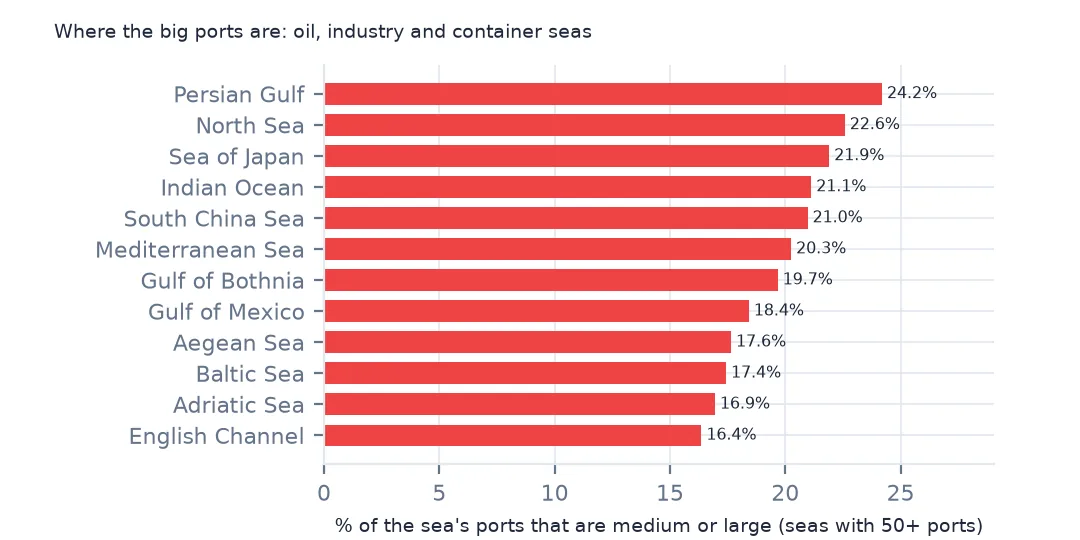
Persian Gulf 62 0.242
North Sea 155 0.226
Sea of Japan 105 0.219
Indian Ocean 71 0.211
South China Sea 62 0.210
Mediterranean Sea 158 0.203
Gulf of Bothnia 61 0.197
Gulf of Mexico 76 0.184
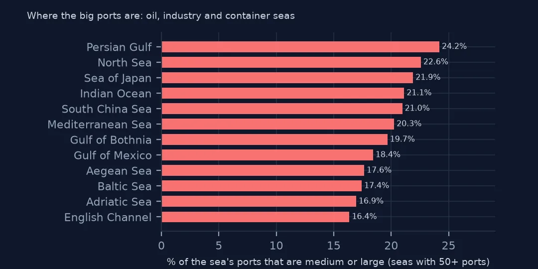
Among seas with 50 or more ports, the Persian Gulf has the largest share of medium and large ports, 24.2%, then the North Sea, the Sea of Japan, the Indian Ocean coast and the South China Sea, all above 20%. These are the seas of oil, industry and container trade, where most ports are built for ocean-going ships.
Internal links
- Ports by country — the same ports by country
- Ports closed by ice — the seas that freeze
- Maritime boundaries explained — the waters countries claim
- Reading the index — the other columns