
Fixing Bank Branch Points Placed at ZIP Code Centres
On this page
Problem statement
Every office in the Summary of Deposits has a latitude and longitude, and the column SIMS_PROJECTION says how each was found: most are matched to the exact address, but some are placed on the street, at a landmark, or at the centre of a ZIP code or town, and a few carry codes nobody documents. The column mixes upper and lower case versions of the same values from different geocoders. This page normalises it, groups the codes by precision, finds the offices that share one point, tests each group against the stated county, and catches two branches whose latitude and longitude are swapped.
Quick answer
Normalise the case of the geocode column and count its values:
q = sod.SIMS_PROJECTION.fillna("missing").str.upper()
print(q.value_counts().head(12).to_string())
SIMS_PROJECTION
EXACT 65639
STREETADDRESS 7009
M 2264
STREETNAME 262
POINTADDRESS 241
POSTAL 189
SUBADDRESS 189
T 130
STREETADDRESSEXT 89
STREETINT 29
POI 12
POSTALLOC 9
Upper-cased, EXACT is 65,639 offices and STREETADDRESS 7,009, which were split between "StreetAddress" and "STREETADDRESS" before. Below them come 2,264 offices coded M, then street-name matches, point addresses, 189 POSTAL matches, 130 T and a tail of rarer codes. Normalising case first halves the number of distinct values.
Precision, shared points and the county test
1. Group the codes
GOOD = {"EXACT", "POINTADDRESS", "STREETADDRESS", "SUBADDRESS", "STREETADDRESSEXT"}
ROUGH = {"STREETNAME", "STREETINT", "DISTANCEMARKER", "ROADKM", "POI"}
AREA = {"POSTAL", "POSTALLOC", "LOCALITY", "SUBADMIN"}
sod["geocode"] = np.select([q.isin(GOOD), q.isin(ROUGH), q.isin(AREA)], ["address", "street or landmark", "ZIP or town centre"], "unknown code")
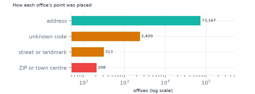
print(sod.geocode.value_counts().to_string())
print(sod[sod.geocode == "unknown code"].SIMS_PROJECTION.value_counts().head(6).to_dict())
geocode
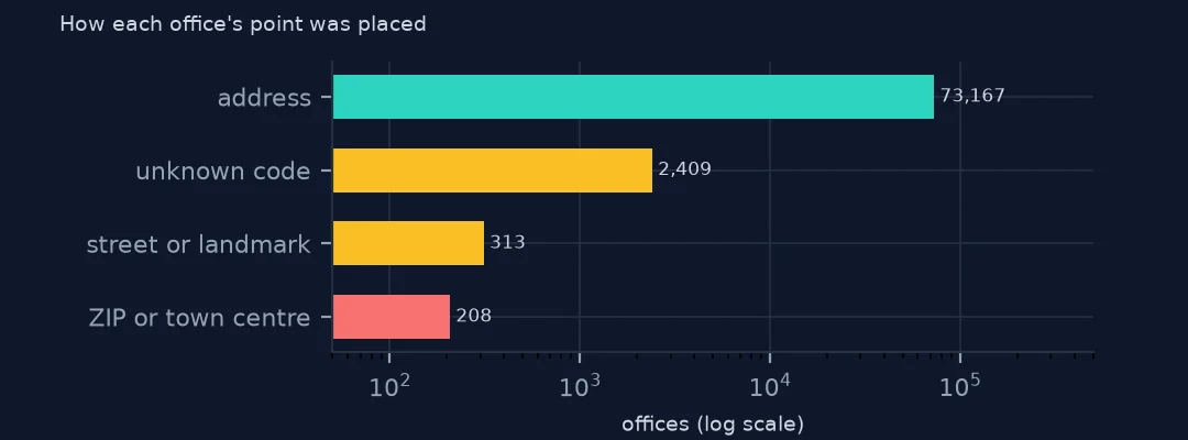
address 73167
unknown code 2409
street or landmark 313
ZIP or town centre 208
{'M': 2264, 'T': 130, 'S01': 2, 'S08': 2, 'U': 2, 'S09': 1}
Grouped by precision, 73,167 offices are placed at an address, 313 on a street or at a landmark and 208 at a ZIP code or town centre. 2,409 carry codes that are not geocoder match types, M and T above all, with a few like S01. They are probably manual placements, but the data does not say, so treat them as unknown rather than exact.
2. Points that share a position
dup = sod.groupby(["SIMS_LATITUDE", "SIMS_LONGITUDE"]).size()
print(f"positions shared by 2+ offices: {(dup > 1).sum():,}, holding {dup[dup > 1].sum():,} offices; most at one point: {dup.max()}")
area = sod[sod.geocode == "ZIP or town centre"]
print(f"ZIP or town centre offices sharing a point: {area.duplicated(['SIMS_LATITUDE', 'SIMS_LONGITUDE'], keep=False).mean():.1%}")
positions shared by 2+ offices: 705, holding 1,523 offices; most at one point: 12
ZIP or town centre offices sharing a point: 4.8%
705 positions are shared by two or more offices, 1,523 offices in all, and the most at one point is 12. Some are genuine, a drive-through next to its branch or several banks in one tower, others are offices placed at the same centroid. Only 4.8% of the ZIP or town centre offices share a point with another office, so most of them would not be caught by looking for duplicates.
3. Does the point fall in the stated county?
counties = gpd.read_file("data/cb_2024_us_county_20m.zip")
g = gpd.GeoDataFrame(sod, geometry=gpd.points_from_xy(sod.SIMS_LONGITUDE, sod.SIMS_LATITUDE), crs=4326).to_crs(counties.crs)
j = gpd.sjoin(g, counties[["GEOID", "geometry"]], how="left", predicate="within")
j = j[~j.index.duplicated()]
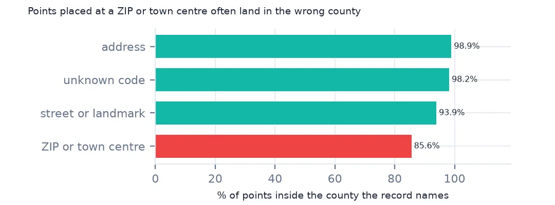
print(j.assign(ok=j.GEOID == j.STCNTYBR).groupby("geocode").ok.mean().round(3).to_string())
geocode
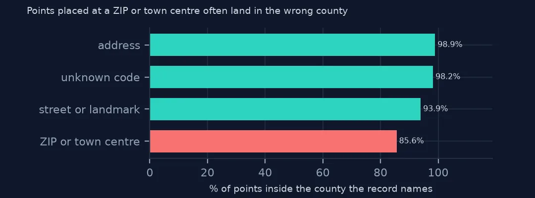
ZIP or town centre 0.856
address 0.989
street or landmark 0.939
unknown code 0.982
Tested against the county in STCNTYBR, 98.9% of address-matched points fall in their own county, and 85.6% of ZIP or town centre points. Street and landmark matches manage 93.9%. A ZIP centre can be in the next county, and for a distance study it can be miles from the branch. The unknown codes do as well as addresses, 98.2%, which suggests they are mostly good.
ZIP centres and swapped coordinates
The data used on this page
The FDIC's Summary of Deposits for 2015 and 2025, every office of every FDIC-insured institution with its deposits as of 30 June, from the BankFind Suite API, downloaded on 28 October 2026 and saved on this site, because banks amend past reports and the API serves the revised figures. Public domain. Deposits are reported in thousands of dollars. County boundaries are the Census Bureau's 2024 cartographic file, public domain.
from pathlib import Path
import zipfile

import geopandas as gpd
import numpy as np
import pandas as pd
import requests

Path("data").mkdir(exist_ok=True)
# FDIC Summary of Deposits for 2015 and 2025 (every branch, deposits as of 30 June) from the BankFind Suite API, with
# the Census Bureau's 2024 county population estimates, 2020 tract centres of population, counties and states.
# Saved 28 October 2026: the API serves revised years as banks amend their reports.
# Live: https://api.fdic.gov/banks/sod?filters=YEAR:2025&limit=10000&offset=0
ARCHIVE = "fdic-sod-2026-10-28.zip"
if not Path(f"data/{ARCHIVE}").exists():
    Path(f"data/{ARCHIVE}").write_bytes(requests.get(f"https://data.spatialworkflow.io/{ARCHIVE}", timeout=600).content)
Z = zipfile.ZipFile(f"data/{ARCHIVE}")
for f in ["cb_2024_us_county_20m.zip", "cb_2024_us_state_20m.zip"]:
    Path(f"data/{f}").write_bytes(Z.read(f))
def read_sod(year):
    d = pd.read_csv(Z.open(f"fdic-sod-{year}.csv"), dtype={"ZIPBR": str})
    d["STCNTYBR"] = d.STCNTYBR.astype(str).str.zfill(5)          # county FIPS, stored as a number
    d["deposits"] = d.DEPSUMBR * 1000                              # reported in thousands of dollars
    return d
sod = read_sod(2025)
print(f"FDIC Summary of Deposits 2025: {len(sod):,} offices, ${sod.deposits.sum() / 1e12:,.2f} trillion in deposits")
FDIC Summary of Deposits 2025: 76,097 offices, $18.10 trillion in deposits
Example 1: distances that ZIP centres distort
area = sod.geocode == "ZIP or town centre"
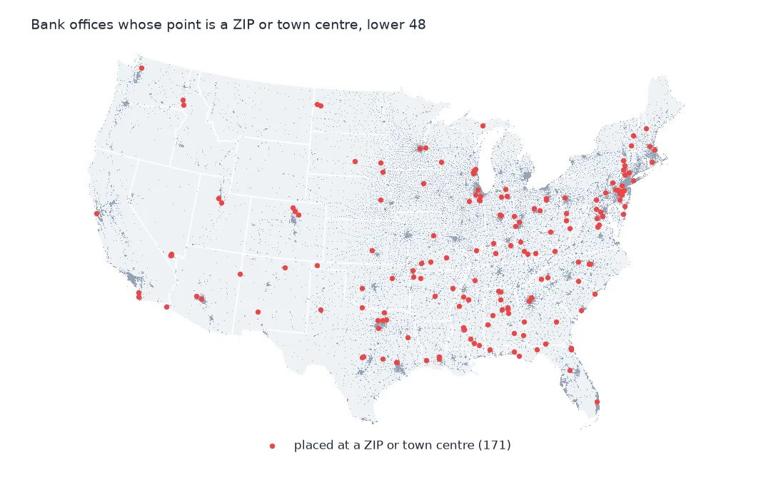
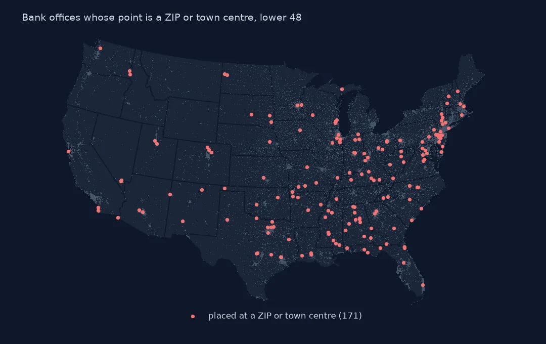
print(f"offices placed at a ZIP or town centre: {area.sum()} ({area.mean():.2%}); in states: {sod[area].STALPBR.value_counts().head(4).to_dict()}")
swap = sod[sod.SIMS_LATITUDE.abs() > 90]
print(swap[["NAMEFULL", "CITYBR", "STALPBR", "SIMS_LATITUDE", "SIMS_LONGITUDE"]].to_string(index=False))
offices placed at a ZIP or town centre: 208 (0.27%); in states: {'AL': 13, 'TX': 13, 'PR': 11, 'MS': 10}
NAMEFULL CITYBR STALPBR SIMS_LATITUDE SIMS_LONGITUDE
Bank of the Federated States of Micronesia Yap FM 158.227518 6.880382
Bank of Guam Yap FM 138.097000 9.538000
208 offices, 0.27%, are placed at a ZIP or town centre, most in Alabama, Texas, Puerto Rico and Mississippi; for a national map that is noise, for a study of one rural county it may be the only branch. Two offices on Yap, in the Federated States of Micronesia, have their latitude and longitude swapped, 158.2 and 6.9: swap any row whose latitude is beyond 90 before projecting, or the reprojection fails.
Internal links
- Bank deserts — distances that depend on these points
- Reading the survey — the coordinate columns
- Geocoding returns wrong coordinates — the same problem in your own geocoding
- Branches per resident — counts that use the county code instead