
How to Read EPA's Superfund National Priorities List in Python
On this page
Problem statement
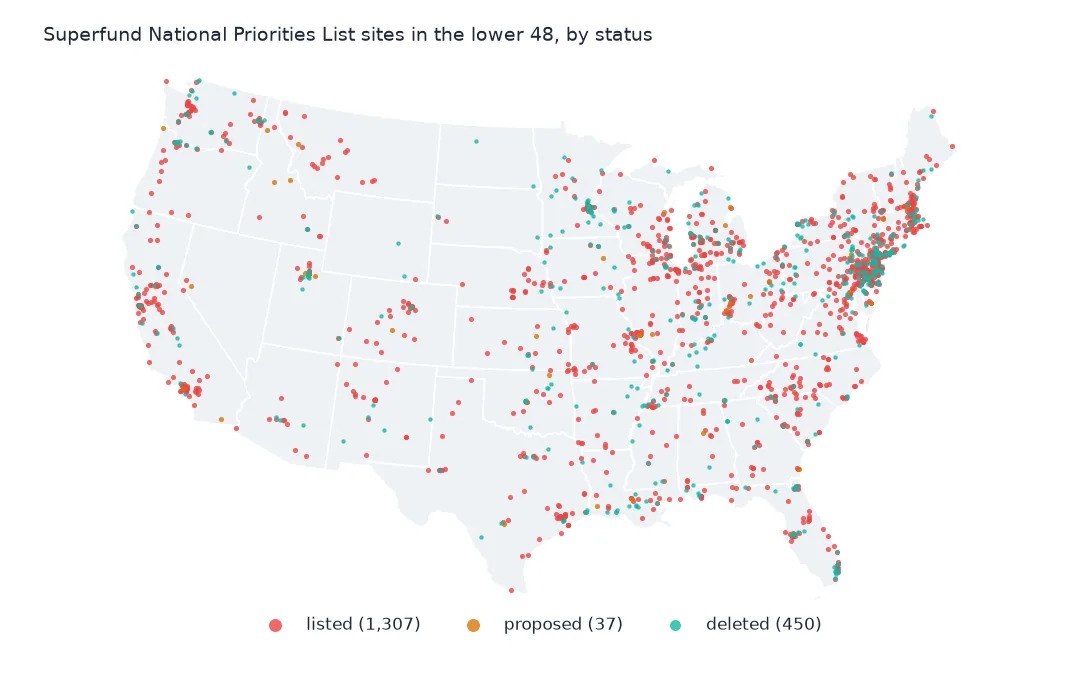
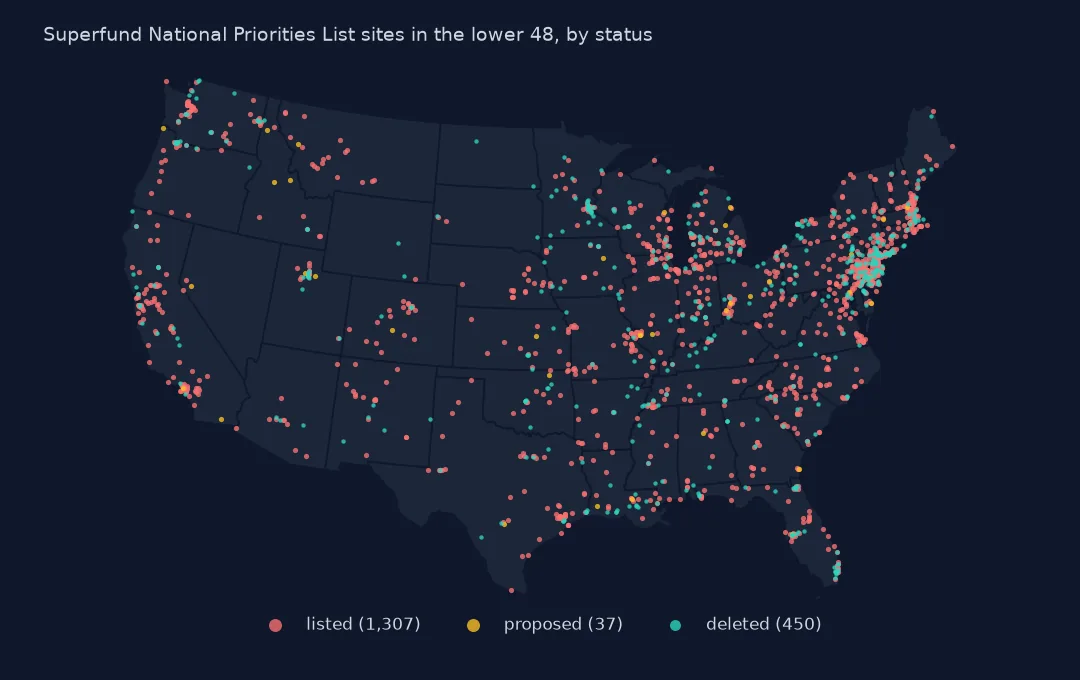
The National Priorities List is EPA's list of the most serious hazardous-waste sites in the United States, the ones eligible for long-term cleanup under the Superfund law. EPA publishes it as a layer with one row per site: 1,840 sites, each with its name, location, status, Hazard Ranking System score and the dates it was proposed, listed, finished construction and deleted. The layer is the basis of every Superfund map, but its dates are text, some columns hold HTML, and the state field mixes states, territories and a freely associated state. This page reads it and makes it usable.
Quick answer
Read the layer and look at the first rows and the status of every site:
print(npl[["Site_Name", "State", "Status", "Site_Score", "Proposed_Date", "Listing_Date", "Deletion_Date"]].head(3).to_string(index=False))
print(npl.Status.value_counts().to_string())
Site_Name State Status Site_Score Proposed_Date Listing_Date Deletion_Date
Alaska Battery Enterprises Alaska Deleted NPL Site 30.98 06/24/1988 03/31/1989 07/26/1996
Fort Wainwright Alaska NPL Site 42.40 07/14/1989 08/30/1990 NaN
Elmendorf Air Force Base Alaska NPL Site 45.91 07/14/1989 08/30/1990 NaN
Status
NPL Site 1337
Deleted NPL Site 466
Proposed NPL Site 37
Each row is one site. Alaska Battery Enterprises in Fairbanks was proposed in 1988, listed in 1989 and deleted in 1996; Fort Wainwright and Elmendorf Air Force Base are still on the list. Of the 1,840 sites, 1,337 are on the list now, 466 have been deleted after cleanup and 37 are proposed and awaiting a final decision.
Ids, dates, places and points
1. Ids and names
print(f"Site_EPA_ID unique: {npl.Site_EPA_ID.is_unique}; SEMS_ID unique: {npl.SEMS_ID.is_unique}; names unique: {npl.Site_Name.is_unique}")
print(npl[npl.Site_Name.duplicated(keep=False)].sort_values("Site_Name")[["Site_Name", "State", "Site_EPA_ID"]].head(4).to_string(index=False))
Site_EPA_ID unique: True; SEMS_ID unique: True; names unique: False
Site_Name State Site_EPA_ID
Gratiot County Golf Course Michigan MID980794531
Gratiot County Golf Course Michigan MIN000510389
Site_EPA_ID and SEMS_ID, the id in EPA's Superfund management system, are both unique, so either can be the key. Names are not: Gratiot County Golf Course in Michigan appears twice with different ids, as two separate sites. Join on the EPA id, never on the name.
2. Dates stored as text
print(npl.Listing_Date.dtype, npl.Listing_Date.dropna().iloc[0])
DATES = ["Proposed_Date", "Listing_Date", "Construction_Completion_Date", "NOID_Date", "Deletion_Date"]
npl[DATES] = npl[DATES].apply(pd.to_datetime, format="%m/%d/%Y")
print(npl[DATES].agg(["count", "min", "max"]).T.to_string())
str 03/31/1989
count min max
Proposed_Date 1840 1981-10-23 00:00:00 2024-09-05 00:00:00
Listing_Date 1798 1983-09-08 00:00:00 2026-03-13 00:00:00
Construction_Completion_Date 1250 1982-12-30 00:00:00 2026-09-23 00:00:00
NOID_Date 464 1985-12-31 00:00:00 2026-03-04 00:00:00
Deletion_Date 467 1982-12-30 00:00:00 2026-08-20 00:00:00
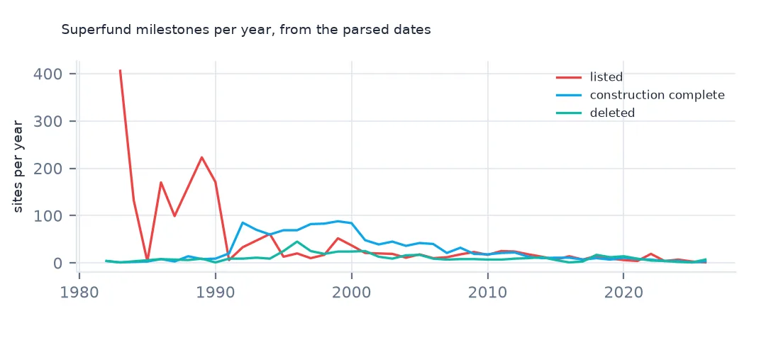
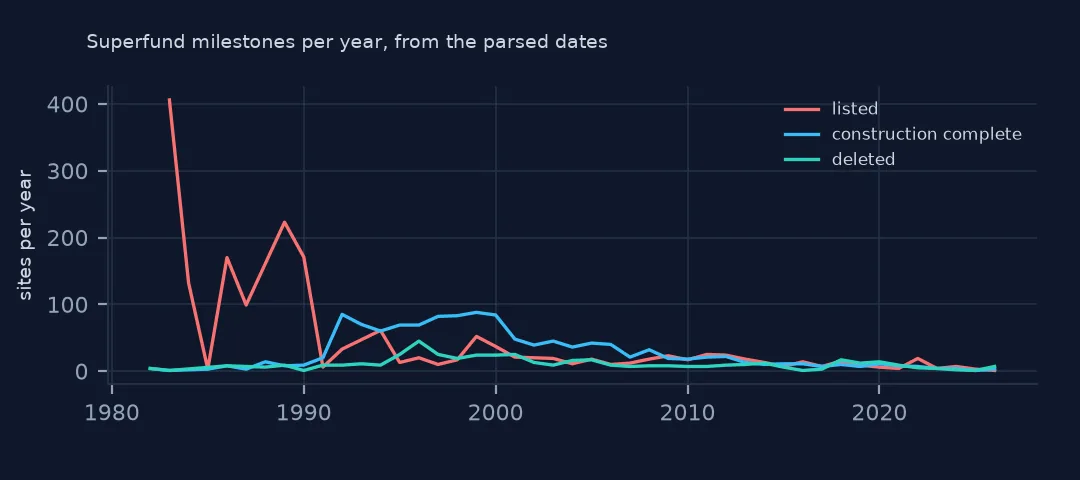
Every date is stored as text in month/day/year form, such as "03/31/1989", so it sorts wrongly and cannot be subtracted until it is parsed. Parsed, every site has a proposal date from 1981 to 2024, 1,798 have a listing date, 1,250 a construction completion date and 467 a deletion date. The earliest completion and deletion, 30 December 1982, predate the first final listing of September 1983: they belong to sites proposed and cleaned up before the list was made final.
3. States, regions and territories
print(f"distinct State values: {npl.State.nunique()}")
print(npl.State.value_counts().tail(6).to_dict())
print(npl.groupby("Region_ID").size().to_dict())
distinct State values: 57
{'Nevada': 2, 'Virgin Islands': 2, 'American Samoa': 1, 'District of Columbia': 1, 'Commonwealth of Northern Marianas': 1, 'Federated States of Micronesia': 1}
{1: 123, 2: 303, 3: 229, 4: 256, 5: 344, 6: 155, 7: 103, 8: 76, 9: 140, 10: 111}
State holds 57 full names, the 50 states plus DC, Puerto Rico, Guam, the Virgin Islands, American Samoa, the "Commonwealth of Northern Marianas" and the Federated States of Micronesia. Map them to postal codes before joining to boundary files. EPA's ten regions are in Region_ID; Region 5, the Great Lakes states, has the most sites, 344, and Region 2, New York, New Jersey and the Caribbean territories, 303.
4. Points
npl = gpd.GeoDataFrame(npl.drop(columns="geometry"), geometry=gpd.points_from_xy(npl.Longitude, npl.Latitude), crs=4326)
print(f"no coordinates: {npl.Longitude.isna().sum()}; bounds: {npl.total_bounds.round(1).tolist()}")
no coordinates: 0; bounds: [-176.7, -14.4, 151.8, 64.8]
The layer comes with no geometry; Longitude and Latitude hold the coordinates and every site has them. They run from American Samoa at 14.4° S to Fairbanks at 64.8° N, and from 176.7° W across the date line to Micronesia at 151.8° E, so a map of the 50 states needs filtering, not just a bounding box.
Sites by state and partial deletions
The data used on this page
The US Environmental Protection Agency's Superfund National Priorities List (NPL) Sites with Status Information and its national Superfund site boundaries, every record of both ArcGIS layers, downloaded on 28 October 2026 and saved on this site, because EPA edits both as sites are proposed, listed, completed and deleted. Public domain. The contact names, telephone numbers and e-mail addresses of EPA staff in the boundary layer were left out of the copy.
from pathlib import Path
import zipfile

import geopandas as gpd
import numpy as np
import pandas as pd
import requests

Path("data").mkdir(exist_ok=True)
# EPA's Superfund National Priorities List with status information and EPA's Superfund site boundaries, with the
# Census Bureau's 2020 tract centres of population, 2024 county estimates, counties and states. Saved 28 October 2026:
# EPA updates both layers as sites are proposed, listed, completed and deleted.
# Live: https://services.arcgis.com/cJ9YHowT8TU7DUyn/arcgis/rest/services/Superfund_National_Priorities_List_(NPL)_Sites_with_Status_Information/FeatureServer/0
ARCHIVE = "epa-superfund-npl-2026-10-28.zip"
if not Path(f"data/{ARCHIVE}").exists():
    Path(f"data/{ARCHIVE}").write_bytes(requests.get(f"https://data.spatialworkflow.io/{ARCHIVE}", timeout=600).content)
Z = zipfile.ZipFile(f"data/{ARCHIVE}")
for f in ["npl-sites-status.geojson", "npl-site-boundaries.geojson", "cb_2024_us_county_20m.zip", "cb_2024_us_state_20m.zip"]:
    if not Path(f"data/{f}").exists():
        Path(f"data/{f}").write_bytes(Z.read(f))
npl = gpd.read_file("data/npl-sites-status.geojson")
print(f"Superfund National Priorities List: {len(npl):,} sites")
Superfund National Priorities List: 1,840 sites
Example 1: sites by state
st = npl.groupby("State").Status.value_counts().unstack(fill_value=0)
st["all"] = st.sum(axis=1)
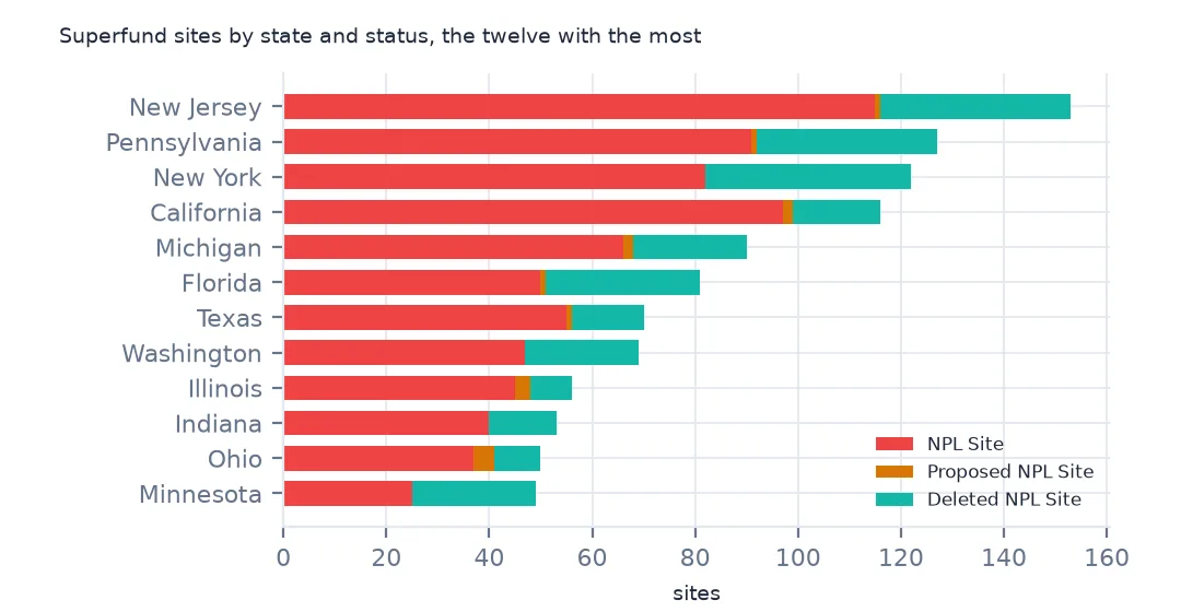
print(st.sort_values("all", ascending=False).head(8).to_string())
Status Deleted NPL Site NPL Site Proposed NPL Site all
State
New Jersey 37 115 1 153
Pennsylvania 35 91 1 127
New York 40 82 0 122
California 17 97 2 116
Michigan 22 66 2 90
Florida 30 50 1 81
Texas 14 55 1 70
Washington 22 47 0 69
New Jersey has the most sites, 153, of which 115 are still listed, then Pennsylvania, New York and California. New York has deleted the most, 40. The list is a map of 20th-century industry: the old manufacturing states of the Northeast and the Great Lakes lead it.
Example 2: partial deletions
print(npl.Site_has_had_a_Partial_Deletion.str[:60].value_counts().to_dict())
npl["partial_deletion"] = npl.Site_has_had_a_Partial_Deletion.str.contains(">Yes<", regex=False)
print(pd.crosstab(npl.Status, npl.partial_deletion).to_string())
{'No': 1721, '<a href="https://www.epa.gov/superfund/partially-deleted-nat': 119}
partial_deletion False True
Status
Deleted NPL Site 459 7
NPL Site 1225 112
Proposed NPL Site 37 0
Site_has_had_a_Partial_Deletion is "No" or an HTML link whose text is "Yes", so a plain value count shows 119 copies of a link. Testing for the text inside it finds 112 listed sites that have had part of their area deleted, and 7 fully deleted sites that had a partial deletion first. EPA deletes parts of large sites once they are cleaned up, while work continues elsewhere.
Internal links
- The National Priorities List explained — what each status means, and getting the data without code
- Sites by county — the points on a map
- Site boundaries — the outlines behind the points
- Joining the list to the boundaries — the ids that do not match